'Nutrition For Cyclists'
This comprehensive ebook is just $2.99!

Cruising Denver’s Greenbelts and Neighborhoods on the Cherry Creek Trail
Denver
Cherry Creek Trail
Distance: 40 Miles
The Cherry Creek Trail is a 40-mile paved corridor that follows Cherry Creek from the southeastern edge of the metro area into downtown Denver, running alongside a natural drainage and flood-control channel. It moves through open parkland, residential zones, and dense city blocks, offering a look at how Denver has grown around its waterways.
The eastern end begins near Cherry Creek State Park. The path skirts the reservoir and grasslands, with relatively few road crossings. This is a nice section for riders who want to maintain a steady pace for a decent stretch.
Heading west, the corridor narrows, with neighborhoods nearby. The trail dips under roads and threads through greenbelts, staying away from traffic even as development increases. Surface conditions are generally good, though sand and debris can appear after storms. Access points appear often, in case you want to bail out or explore off the trail.
Cruising past the sights
Closer to central Denver, foot traffic increases near trailheads and crossings, and the pace becomes more stop-and-go during commute hours. This is also where the trail begins to pass some of Denver’s better-known destinations.
The trail passes near the Denver Botanic Gardens, an easy side trip. Farther downstream, connections lead to the Cherry Creek Shopping Center, a major retail and dining hub with plenty of cafés for a mid-ride stop. As the creek approaches the South Platte River, riders are close to Confluence Park, a lively gathering spot and gateway to additional trail networks.
The Denver Art Museum and Civic Center Park are short detours away, while riverfront paths lead toward attractions such as the Downtown Aquarium.
Heads up downtown
Downtown junctions can be a bit confusing where multiple routes intersect. The trail links to the South Platte corridor, giving you additional options. Be aware here, it can be tricky to stay on course.
After heavy rain, short closures can occur due to flood-control operations. Crowding in the city core can slow progress, and sometimes there may be debris near the creek. If you are looking for quieter miles, you may prefer the outer sections.
The Cherry Creek Trail is a convenient trail for moving across Denver. Its length, access to parks and destinations, and direct path from open space to downtown make it a key route for riders who want decent mileage and a nice look at the city along the way.
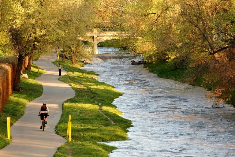
Riding the Cherry Creek Trail in Denver Photo: Dan Long, Flickr


Cherry Creek Trail
Distance: 40 Miles
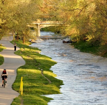
The Cherry Creek Trail is a 40-mile paved corridor that follows Cherry Creek from the southeastern edge of the metro area into downtown Denver, running alongside a natural drainage and flood-control channel. It moves through open parkland, residential zones, and dense city blocks, offering a look at how Denver has grown around its waterways.
The eastern end begins near Cherry Creek State Park. The path skirts the reservoir and grasslands, with relatively few road crossings. This is a nice section for riders who want to maintain a steady pace for a decent stretch.
Heading west, the corridor narrows, with neighborhoods nearby. The trail dips under roads and threads through greenbelts, staying away from traffic even as development increases. Surface conditions are generally good, though sand and debris can appear after storms. Access points appear often, in case you want to bail out or explore off the trail.
Cruising past the sights
Closer to central Denver, foot traffic increases near trailheads and crossings, and the pace becomes more stop-and-go during commute hours. This is also where the trail begins to pass some of Denver’s better-known destinations.
The trail passes near the Denver Botanic Gardens, an easy side trip. Farther downstream, connections lead to the Cherry Creek Shopping Center, a major retail and dining hub with plenty of cafés for a mid-ride stop. As the creek approaches the South Platte River, riders are close to Confluence Park, a lively gathering spot and gateway to additional trail networks.
The Denver Art Museum and Civic Center Park are short detours away, while riverfront paths lead toward attractions such as the Downtown Aquarium.
Heads up downtown
Downtown junctions can be a bit confusing where multiple routes intersect. The trail links to the South Platte corridor, giving you additional options. Be aware here, it can be tricky to stay on course.
After heavy rain, short closures can occur due to flood-control operations. Crowding in the city core can slow progress, and sometimes there may be debris near the creek. If you are looking for quieter miles, you may prefer the outer sections.
The Cherry Creek Trail is a convenient trail for moving across Denver. Its length, access to parks and destinations, and direct path from open space to downtown make it a key route for riders who want decent mileage and a nice look at the city along the way.

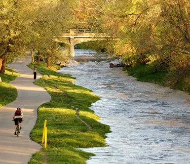
Riding the Cherry Creek Trail in Denver Photo: Dan Long, Flickr
Some pages contain affiliate links. If you purchase something through one of these links, we may earn a small commission.