'Nutrition For Cyclists'
This comprehensive ebook is just $2.99!

Cyclists Don’t Fear the Falls on the Grand Rounds Scenic Byway
Minneapolis
Grand Rounds Scenic Byway
Distance: 51 Miles
The Grand Rounds Scenic Byway covers about 51 miles around Minneapolis. The route links lakes, river corridors and city parkland through a network of paved paths and parkways. Most sections keep cyclists away from motor traffic, though short street crossings appear in places. Because the route forms a large loop with several branches, you can ride short segments or build a full-day circuit depending on time and conditions.
Many riders begin near the Chain of Lakes district, where paths circle water and pass through some of Minneapolis’s busiest parks. Lakes such as Lake Harriet and Bde Maka Ska are busy during warm months. The trail is paved and generally well maintained, with marked lanes for cyclists and pedestrians in several areas. During weekends and summer evenings, traffic from walkers, runners, and families increases.
A bike ride with falls
From the lakes district, the route heads south toward one of the system’s most recognized landmarks: Minnehaha Falls. The path descends gradually toward the falls and the surrounding parkland. You can stop here for water, restrooms and food stands that operate during the warmer season. The area also connects to trails along Minnehaha Creek if you want to extend the outing beyond the main loop.
Continuing north from Minnehaha Falls brings you to the Mississippi River corridor. The trail runs along the bluffs above the river for several miles, providing long views across the water and wooded shoreline. This portion links with other regional paths that follow the river through Minneapolis and neighboring communities. Pavement remains smooth in most sections, though debris can appear after storms, particularly where the trail runs beneath tree cover.
Heads up in neighborhoods
North Minneapolis presents a different setting. Parks and parkways remain frequent, but the trail passes through residential areas with more street crossings. Traffic signals and marked intersections manage most of these points, but be attentive here. Community parks and recreation areas appear regularly along the route, with water fountains and restrooms available during the operating season.
As the loop continues east and then back south, the trail reconnects with the Chain of Lakes area. Several segments are parallel to park roads where vehicle speeds are limited, while nearby paved paths remain available for cyclists who prefer to stay away from cars. Because the system includes multiple access points, parking areas and park entrances, you can start almost anywhere along the loop without difficulty.
Food and drink is plentiful around the lakes district and the neighborhoods near Minnehaha Park. Coffee shops and restaurants sit within a few blocks of many trail crossings, especially around Lake Harriet and Bde Maka Ska. Riders covering longer distances often plan a stop near these areas since services become less frequent along the northern river sections.
Summer brings heavy use from residents and visitors. Autumn introduces fallen leaves on shaded stretches, and spring flooding occasionally affects low areas near creeks or the river. Winter cycling is common in Minneapolis, though snow amounts and grooming determine accessibility.
Frequent entry points and a well-maintained paved corridor through much of the route means you can ride short park loops or complete the full circuit around the city.
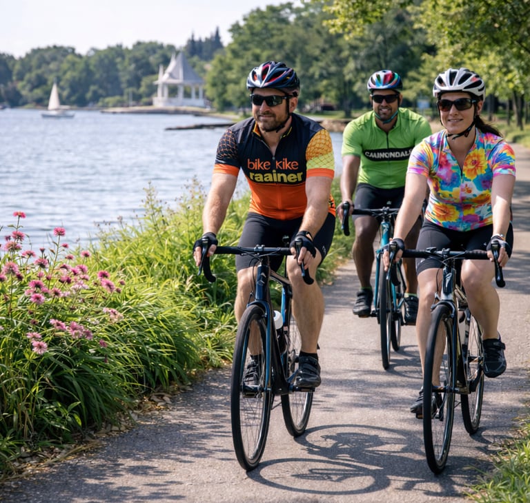
Cycling on the Grand Rounds Scenic Byway (AI Image)

This affordable cycling computer has all the features you need!
Grand Rounds Scenic Byway
Distance: 51 Miles
The Grand Rounds Scenic Byway covers about 51 miles around Minneapolis. The route links lakes, river corridors and city parkland through a network of paved paths and parkways. Most sections keep cyclists away from motor traffic, though short street crossings appear in places. Because the route forms a large loop with several branches, you can ride short segments or build a full-day circuit depending on time and conditions.
Many riders begin near the Chain of Lakes district, where paths circle water and pass through some of Minneapolis’s busiest parks. Lakes such as Lake Harriet and Bde Maka Ska are busy during warm months. The trail is paved and generally well maintained, with marked lanes for cyclists and pedestrians in several areas. During weekends and summer evenings, traffic from walkers, runners, and families increases.
A bike ride with falls
From the lakes district, the route heads south toward one of the system’s most recognized landmarks: Minnehaha Falls. The path descends gradually toward the falls and the surrounding parkland. You can stop here for water, restrooms and food stands that operate during the warmer season. The area also connects to trails along Minnehaha Creek if you want to extend the outing beyond the main loop.
Continuing north from Minnehaha Falls brings you to the Mississippi River corridor. The trail runs along the bluffs above the river for several miles, providing long views across the water and wooded shoreline. This portion links with other regional paths that follow the river through Minneapolis and neighboring communities. Pavement remains smooth in most sections, though debris can appear after storms, particularly where the trail runs beneath tree cover.
Heads up in neighborhoods
North Minneapolis presents a different setting. Parks and parkways remain frequent, but the trail passes through residential areas with more street crossings. Traffic signals and marked intersections manage most of these points, but be attentive here. Community parks and recreation areas appear regularly along the route, with water fountains and restrooms available during the operating season.
As the loop continues east and then back south, the trail reconnects with the Chain of Lakes area. Several segments are parallel to park roads where vehicle speeds are limited, while nearby paved paths remain available for cyclists who prefer to stay away from cars. Because the system includes multiple access points, parking areas and park entrances, you can start almost anywhere along the loop without difficulty.
Food and drink is plentiful around the lakes district and the neighborhoods near Minnehaha Park. Coffee shops and restaurants sit within a few blocks of many trail crossings, especially around Lake Harriet and Bde Maka Ska. Riders covering longer distances often plan a stop near these areas since services become less frequent along the northern river sections.
Summer brings heavy use from residents and visitors. Autumn introduces fallen leaves on shaded stretches, and spring flooding occasionally affects low areas near creeks or the river. Winter cycling is common in Minneapolis, though snow amounts and grooming determine accessibility.
Frequent entry points and a well-maintained paved corridor through much of the route means you can ride short park loops or complete the full circuit around the city.
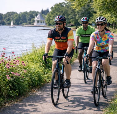
Cycling on the Grand Rounds Scenic Byway (AI Image)
This affordable cycling computer has all the features you need!
Some pages contain affiliate links. If you purchase something through one of these links, we may earn a small commission.