'Nutrition For Cyclists'
This comprehensive ebook is just $2.99!

Loire à Vélo: A 560-Mile Ride Following France’s Scenic River
Nevers
Loire à Vélo
Distance: 560 miles (complete route)
Trail Map
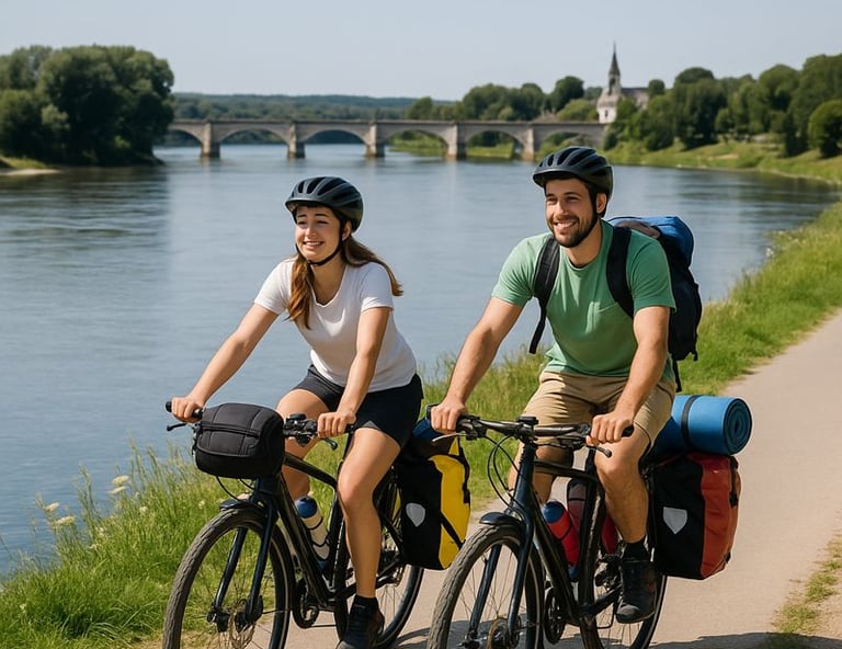
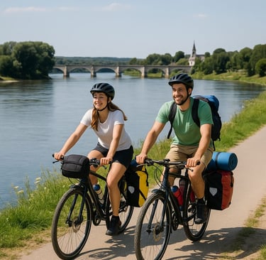
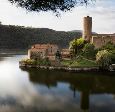
Loire à Vélo is a fully marked, long-distance cycling route that follows the Loire River for roughly 560 miles, beginning in Nevers in eastern France and finishing at the Atlantic coast in Saint-Brévin-les-Pins. It is one of Europe’s most established bike routes, built around accessibility rather than difficulty, and can easily be ridden in stages rather than a single push. The route uses dedicated bike paths, quiet farm roads, levee-top tracks, and short urban connectors, all tied together with clear signage in both directions.
Riders often carry a dedicated Loire à Vélo cycling guidebook, which breaks the journey into manageable stages and highlights châteaux, river access points, and overnight stops along the way.
From Nevers, the Loire is rarely far from view, and even when the path drifts inland briefly, it soon returns to the water’s edge. Riders often note that the river route offers long sightlines, gentle curves, and a lack of abrupt elevation changes. The surfaces go from smooth pavement in towns to compacted gravel along flood defenses, but they are all consistently rideable.
Cycling into French farmland and villages
As the route moves west, the character of the landscape changes gradually. Early sections pass through farmland, wooded riverbanks, and quiet villages where daily services are never far apart. Many cyclists remark that planning feels almost unnecessary, as food, lodging, and water seem to appear naturally along the way. Bakeries, small cafés, and village markets provide frequent opportunities to stop without deviating far from the route.
The central Loire Valley is the iconic, unforgettable part of the ride. Between Orléans, Blois, and Amboise, the path moves through the heart of the Loire’s château country, a UNESCO World Heritage landscape. Riders pass near monumental sites such as Château de Chambord, Château de Blois, and Château d’Amboise, often encountering them unexpectedly after quiet stretches along the river. Even cyclists with little interest in formal sightseeing tend to slow here, drawn in by the scale of the architecture and how closely it integrates with the river and surrounding forests.
Wildlife and vineyards
Sandbanks appear midstream, birdlife is abundant, and the Loire’s braided channels shift daily with light and water levels. Riders frequently comment on how the changing light becomes part of the ride, with early mornings offering reflections on still water and evenings casting long shadows across the floodplain.
West of Tours, vineyards become a defining feature. The route passes through wine regions such as Vouvray, Saumur, and Anjou, where vines climb gentle slopes above the river. Small wine producers line the route, and many cyclists choose to stop for tastings or lunch at local domaines. Towns like Tours, Saumur, and Angers have walkable centers, riverside promenades, and cafés ideal for extended breaks. Cyclists often mention how easy it is to balance riding with long lunches, museum visits, or time spent along the water.
Route conditions, natural highlights, and the Atlantic finish
Cycling the Loire à Vélo takes riders up climbs that are short and infrequent, and most days involve gradual rolling. Wind can be a factor in the western sections, especially as the river widens, but shelter is usually close at hand. The route is well maintained, and navigation is rarely an issue thanks to good signage.
As the Loire approaches the coast, forested banks give way to broad wetlands, reed beds, and expansive views of the river’s estuary. Wildlife becomes more prominent. Around Nantes, the Loire takes on a more industrial and maritime character, yet green spaces and riverside paths keep the riding pleasant and continuous.
The final stretch to Saint-Brévin-les-Pins is not demanding. Riders often describe a sense of completion as the river finally reaches the Atlantic. The sea, salt air, and open horizon marks a clear transition from river journey to your arrival at the coast.
Loire à Vélo is exceptionally rider-friendly. Bike-friendly accommodations are common, train stations appear regularly along the route, and luggage transfer services make it accessible. Many riders complete the route over two to three weeks, while others sample shorter sections over multiple trips.
Loire à Vélo is not a route built around challenge or speed. For cyclists looking for a long-distance ride where scenery and services are plentiful, it remains one of Europe’s most rewarding cycling experiences.
Route Summary: Loire à Vélo
Location: Central and Western France
Route Length: 560 miles (900 km)
Start: Nevers, France
Finish: Saint-Brévin-les-Pins (Atlantic coast)
Surface: Mostly paved bike paths and quiet roads, with short sections of compacted gravel on river levees
Elevation: Minimal overall; rolling terrain with no sustained climbs
Best Season: May–June and September (warm, fewer crowds, vineyards active)
Navigation: Fully signed in both directions; GPS optional
Services: Frequent towns, cafés, bakeries, lodging, train access throughout
Route Style: River-following, town-to-town touring with strong cultural and natural emphasis
Cycling the Loire River Trail
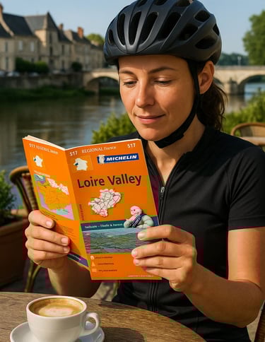

Go old school with this Michelin guide in your jersey pocket.
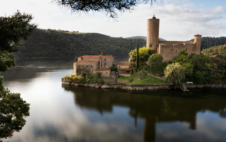
The Loire's channels are ever-shifting, a beautiful vista for cyclists.
Loire à Vélo
Distance: 560 miles (complete route)
Trail Map
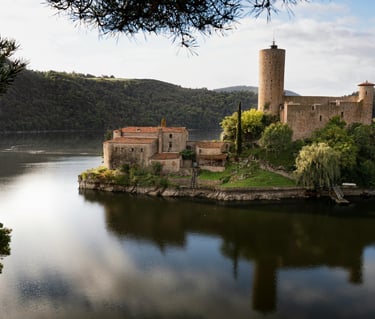
Loire à Vélo is a fully marked, long-distance cycling route that follows the Loire River for roughly 560 miles, beginning in Nevers in eastern France and finishing at the Atlantic coast in Saint-Brévin-les-Pins. It is one of Europe’s most established bike routes, built around accessibility rather than difficulty, and can easily be ridden in stages rather than a single push. The route uses dedicated bike paths, quiet farm roads, levee-top tracks, and short urban connectors, all tied together with clear signage in both directions.
Riders often carry a dedicated Loire à Vélo cycling guidebook, which breaks the journey into manageable stages and highlights châteaux, river access points, and overnight stops along the way.
From Nevers, the Loire is rarely far from view, and even when the path drifts inland briefly, it soon returns to the water’s edge. Riders often note that the river route offers long sightlines, gentle curves, and a lack of abrupt elevation changes. The surfaces go from smooth pavement in towns to compacted gravel along flood defenses, but they are all consistently rideable.
Cycling into French farmland and villages
As the route moves west, the character of the landscape changes gradually. Early sections pass through farmland, wooded riverbanks, and quiet villages where daily services are never far apart. Many cyclists remark that planning feels almost unnecessary, as food, lodging, and water seem to appear naturally along the way. Bakeries, small cafés, and village markets provide frequent opportunities to stop without deviating far from the route.
The central Loire Valley is the iconic, unforgettable part of the ride. Between Orléans, Blois, and Amboise, the path moves through the heart of the Loire’s château country, a UNESCO World Heritage landscape. Riders pass near monumental sites such as Château de Chambord, Château de Blois, and Château d’Amboise, often encountering them unexpectedly after quiet stretches along the river. Even cyclists with little interest in formal sightseeing tend to slow here, drawn in by the scale of the architecture and how closely it integrates with the river and surrounding forests.
Wildlife and vineyards
Sandbanks appear midstream, birdlife is abundant, and the Loire’s braided channels shift daily with light and water levels. Riders frequently comment on how the changing light becomes part of the ride, with early mornings offering reflections on still water and evenings casting long shadows across the floodplain.
West of Tours, vineyards become a defining feature. The route passes through wine regions such as Vouvray, Saumur, and Anjou, where vines climb gentle slopes above the river. Small wine producers line the route, and many cyclists choose to stop for tastings or lunch at local domaines. Towns like Tours, Saumur, and Angers have walkable centers, riverside promenades, and cafés ideal for extended breaks. Cyclists often mention how easy it is to balance riding with long lunches, museum visits, or time spent along the water.
Route conditions, natural highlights, and the Atlantic finish
Cycling the Loire à Vélo takes riders up climbs that are short and infrequent, and most days involve gradual rolling. Wind can be a factor in the western sections, especially as the river widens, but shelter is usually close at hand. The route is well maintained, and navigation is rarely an issue thanks to good signage.
As the Loire approaches the coast, forested banks give way to broad wetlands, reed beds, and expansive views of the river’s estuary. Wildlife becomes more prominent. Around Nantes, the Loire takes on a more industrial and maritime character, yet green spaces and riverside paths keep the riding pleasant and continuous.
The final stretch to Saint-Brévin-les-Pins is not demanding. Riders often describe a sense of completion as the river finally reaches the Atlantic. The sea, salt air, and open horizon marks a clear transition from river journey to your arrival at the coast.
Loire à Vélo is exceptionally rider-friendly. Bike-friendly accommodations are common, train stations appear regularly along the route, and luggage transfer services make it accessible. Many riders complete the route over two to three weeks, while others sample shorter sections over multiple trips.
Loire à Vélo is not a route built around challenge or speed. For cyclists looking for a long-distance ride where scenery and services are plentiful, it remains one of Europe’s most rewarding cycling experiences.
Route Summary: Loire à Vélo
Location: Central and Western France
Route Length: 560 miles (900 km)
Start: Nevers, France
Finish: Saint-Brévin-les-Pins (Atlantic coast)
Surface: Mostly paved bike paths and quiet roads, with short sections of compacted gravel on river levees
Elevation: Minimal overall; rolling terrain with no sustained climbs
Best Season: May–June and September (warm, fewer crowds, vineyards active)
Navigation: Fully signed in both directions; GPS optional
Services: Frequent towns, cafés, bakeries, lodging, train access throughout
Route Style: River-following, town-to-town touring with strong cultural and natural emphasis
Cycling the Loire River Trail
Go old school with this Michelin guide in your jersey pocket.
The Loire's channels are ever-shifting, a beautiful vista for cyclists.
Some pages contain affiliate links. If you purchase something through one of these links, we may earn a small commission.