'Nutrition For Cyclists'
This comprehensive ebook is just $2.99!

Vancouver’s Seawall: 28 Kilometers Around Waterfront Forest and City
Vancouver
The Vancouver Seawall
Distance: 17.4 miles
The Vancouver Seawall is a 28-kilometer (17.4-mile) paved waterfront route that loops around Coal Harbour, encircles Stanley Park, continues along English Bay, and follows False Creek all the way to Olympic Village. It’s one of the rare long city rides where the scenery changes every few minutes — marinas, forests, beaches, bridges, and skyline views — while the riding remains flat and smooth.
Starting in Coal Harbour, the path is wide, threading between high-rise towers and the water’s edge. The marinas give the ride an interesting beginning, with seaplanes taking off across the inlet and boats drifting in and out. Along the way, cafés such as Caffe Artigiano make convenient pre-ride stops, and there’s easy bike access from the waterfront steps near the Vancouver Convention Centre. From here, the route bends toward the entrance of Stanley Park.
Fine views and plenty of distractions
The Stanley Park loop is about 10 kilometers (6.2 miles) and feels separate from the rest of Vancouver, even though it sits beside downtown. Towering cedars and firs rise above the trail, and the seawall hugs rocky edges where waves hit at high tide. The views are across Burrard Inlet toward the North Shore Mountains, and landmarks such as the Lions Gate Bridge, Siwash Rock, and the Brockton Point Lighthouse come into view. Stanley Park has several attractions worth pausing for: the Vancouver Aquarium, the Totem Poles, and the forest picnic areas scattered throughout the interior trails.
Rounding the park’s western curve, the route enters English Bay, a sunny beachfront area with an upbeat vibe. Restaurants and snack spots line the waterfront — places like Cactus Club Café, Delany’s Coffee, and seasonal ice-cream stands make it easy to pause and refuel. The beach itself is busy in summer, so cyclists often slow through this section. The sunsets here are some of the best in the area.
Take in the view at a café stop
At False Creek, the Seawall again becomes more urban but remains scenic. Bridges arch overhead, kayakers move along the water, and the trail passes playgrounds, small parks, and waterfront patios. Granville Island sits just off the path. Cyclists often stop here to grab a meal from the Public Market, browse artisan shops, or enjoy the views from the ferry docks. Past Granville Island, the Seawall winds through newer neighborhoods with plenty of stops, including the cafés around Olympic Village Square.
The pavement across the entire Seawall is smooth, and the grade never presents a challenge. It can get crowded, especially on sunny afternoons and weekends. Facilities are abundant — restrooms, water fountains, beaches, bike rentals, and cafés appear regularly. Wind can be a factor along the northern edge of Stanley Park, and weather shifts quickly near the water.
Despite being fully urban, the Seawall takes in a number of views. Forest, ocean, skyline, beaches, marinas, markets, and quiet coves all appear on a single loop. It’s a low-stress ride packed with scenery and convenient stops, making it a great waterfront route.
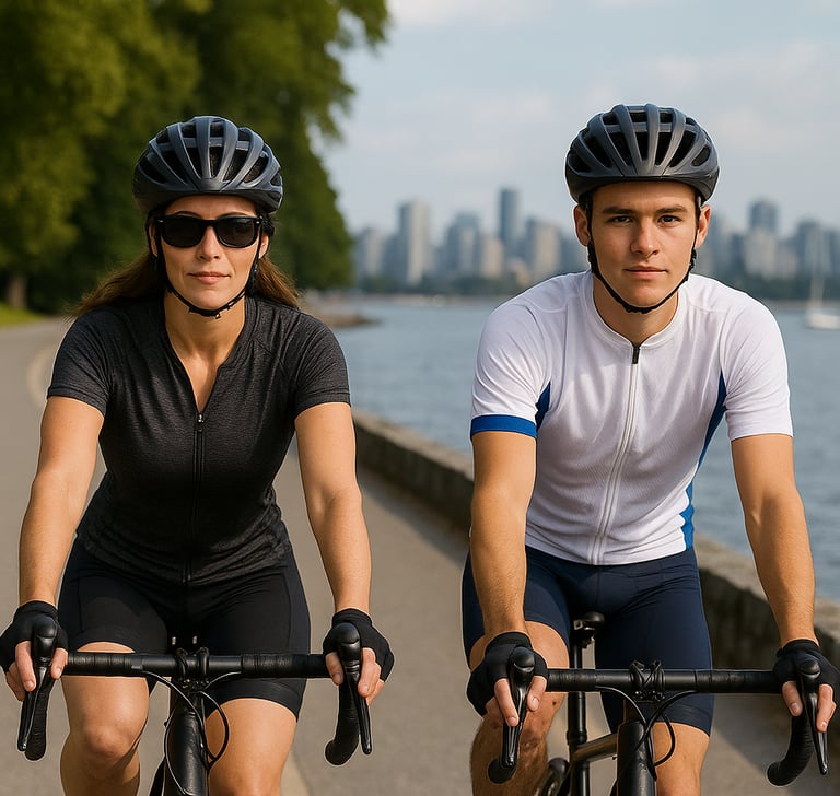
Cycling in Vancouver: Highrises and striking views
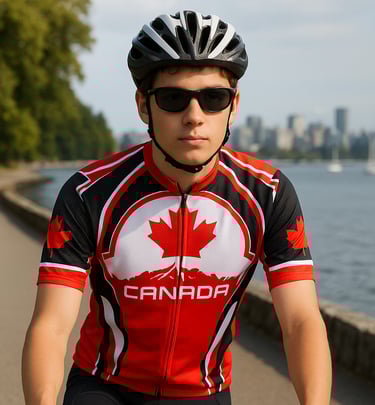
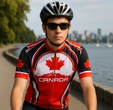
Cruising in Canada - Maple Leaf Style
The Vancouver Seawall
Distance: 17.4 miles
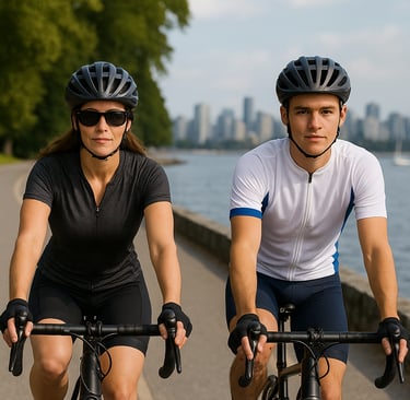
The Vancouver Seawall is a 28-kilometer (17.4-mile) paved waterfront route that loops around Coal Harbour, encircles Stanley Park, continues along English Bay, and follows False Creek all the way to Olympic Village. It’s one of the rare long city rides where the scenery changes every few minutes — marinas, forests, beaches, bridges, and skyline views — while the riding remains flat and smooth.
Starting in Coal Harbour, the path is wide, threading between high-rise towers and the water’s edge. The marinas give the ride an interesting beginning, with seaplanes taking off across the inlet and boats drifting in and out. Along the way, cafés such as Caffe Artigiano make convenient pre-ride stops, and there’s easy bike access from the waterfront steps near the Vancouver Convention Centre. From here, the route bends toward the entrance of Stanley Park.
Fine views and plenty of distractions
The Stanley Park loop is about 10 kilometers (6.2 miles) and feels separate from the rest of Vancouver, even though it sits beside downtown. Towering cedars and firs rise above the trail, and the seawall hugs rocky edges where waves hit at high tide. The views are across Burrard Inlet toward the North Shore Mountains, and landmarks such as the Lions Gate Bridge, Siwash Rock, and the Brockton Point Lighthouse come into view. Stanley Park has several attractions worth pausing for: the Vancouver Aquarium, the Totem Poles, and the forest picnic areas scattered throughout the interior trails.
Rounding the park’s western curve, the route enters English Bay, a sunny beachfront area with an upbeat vibe. Restaurants and snack spots line the waterfront — places like Cactus Club Café, Delany’s Coffee, and seasonal ice-cream stands make it easy to pause and refuel. The beach itself is busy in summer, so cyclists often slow through this section. The sunsets here are some of the best in the area.
Take in the view at a café stop
At False Creek, the Seawall again becomes more urban but remains scenic. Bridges arch overhead, kayakers move along the water, and the trail passes playgrounds, small parks, and waterfront patios. Granville Island sits just off the path. Cyclists often stop here to grab a meal from the Public Market, browse artisan shops, or enjoy the views from the ferry docks. Past Granville Island, the Seawall winds through newer neighborhoods with plenty of stops, including the cafés around Olympic Village Square.
The pavement across the entire Seawall is smooth, and the grade never presents a challenge. It can get crowded, especially on sunny afternoons and weekends. Facilities are abundant — restrooms, water fountains, beaches, bike rentals, and cafés appear regularly. Wind can be a factor along the northern edge of Stanley Park, and weather shifts quickly near the water.
Despite being fully urban, the Seawall takes in a number of views. Forest, ocean, skyline, beaches, marinas, markets, and quiet coves all appear on a single loop. It’s a low-stress ride packed with scenery and convenient stops, making it a great waterfront route.
Cycling in Vancouver: Highrises and striking views
Cruising in Canada - Maple Leaf Style
Some pages contain affiliate links. If you purchase something through one of these links, we may earn a small commission.